Online travel animators that really work on PC and Mac
The five online travel animators that actually work on a PC or Mac browser are Map Route, Google Earth Studio, Mapimator, AvoMap, and Anim8map. Each one can produce a moving map video from a laptop without forcing you onto a phone-only app.
They are not interchangeable. Map Route is a fast two-point journey clip. Google Earth Studio is a cinematic Earth-camera tool. Mapimator and AvoMap are fuller online map studios. Anim8map is a simpler web route renderer. This article names all five, then shows a Map Route workflow for routes such as New York to Los Angeles by road or France to Japan as a geodesic line.
The five online travel animators for PC and Mac
These five are real products you can open on a Windows or Mac computer. Mobile-only apps such as TravelBoast are useful on a phone, but they are not this list. Plans, watermarks, and export limits change, so treat competitor details below as a category fit — not a live spec sheet.
1. Map Route (maproute.org)
Map Route is a free, browser-based travel map animation maker. You search a From and To place, pick Road, Rail, Air corridor, or Geodesic, and generate a short cinematic clip with a kilometer tracker. It runs in Chrome or Safari on PC and Mac with no install. Each generate is exactly two endpoints. Downloads (after a verified account) are a browser capture with a Made with MapRoute.org watermark. Use it when you want an honest two-city journey clip in minutes.
2. Google Earth Studio
Google Earth Studio is Google’s browser-based tool for animating a camera over Google Earth. Creators use it for cinematic location flyovers, establishing shots, and Earth-scale motion — not a one-click city-pair travel clip. It is aimed at desktop browsers and typically requires a Google account. Exact export formats, project limits, and access rules belong on Google’s current product page. Choose it when you need a 3D Earth camera, not a labeled road/rail/air journey with a km counter.
3. Mapimator
Mapimator is an online map animation studio that runs in the browser, so it is usable on PC and Mac without After Effects. It is publicly positioned for YouTube, TikTok, Shorts, and presentations: you add routes or markers on a map and export a video. Public materials describe camera keyframes and social-ready exports. Do not treat that as a guaranteed feature matrix — confirm what the live site offers before you promise a client a specific resolution, watermark policy, or plan. Use it when you want more map-studio control than a two-point generator.
4. AvoMap
AvoMap is a browser-based route animation tool for PC and Mac. Public descriptions focus on turning a journey into an animated map video, including from GPX or KML files or by drawing a route in the editor. Mixed travel segments (drive, walk, flight) are part of how the product describes itself; verify that workflow on avomap.com rather than assuming it matches Map Route’s four visualization modes. Use it when you have a GPS track or want a multi-segment route built in the browser.
5. Anim8map
Anim8map is a web-based travel map animation tool. It is generally described as a browser workflow: drop pins or a route, pick a transport-style icon, and export a map video, including a globe-style view in some public comparisons. Keep expectations general until you check the live product for watermarks, free-tier limits, and whether it runs well in your browser. Use it as a lightweight web alternative when you want a styled route video without installing a desktop suite.
Adobe After Effects is excellent motion-graphics software on PC and Mac, but it is installed desktop software, not an online animator. TravelBoast is a well-known mobile travel-animation app and is not a PC/Mac browser tool. Neither belongs in this five.
How to use Map Route on PC and Mac
Map Route is a browser-based travel map animation maker at maproute.org. It focuses on one thing: visualizing geography between two places with a moving marker and a distance counter. There’s no app to install and no desktop plugin, so it works on both PC and Mac as long as you have a modern browser like Chrome or Safari.
You can use it to animate classic routes like New York → Los Angeles by road, or a France → Japan geodesic line that shows the straight-line distance across the globe. It’s built for creators who want a simple, clean map animation they can drop into a longer edit.
How Map Route works step by step
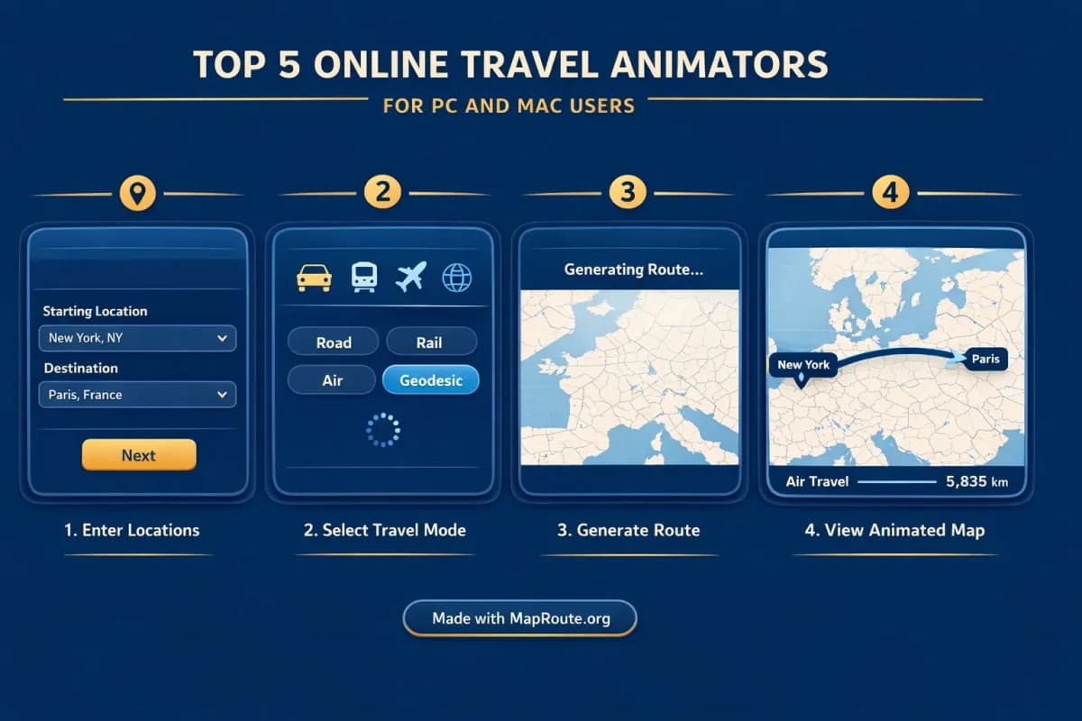
- Open maproute.org in your browser on PC or Mac. There’s no download or install.
- In the composer, type your From location (for example, “New York”). Start with at least two characters; you’ll see suggestions with labels and context.
- Type your To location (for example, “Los Angeles” or “Japan”). Again, pick from the suggestions so the tool knows exactly which place you mean.
- Choose one visualization mode: Road, Rail, Air corridor, or Geodesic. For New York → Los Angeles by road, select Road. For France → Japan straight-line distance, select Geodesic.
- Click Generate Journey. Map Route runs through its prep stages (resolving places, requesting geometry, framing the map, preparing journey).
- Watch the animation. A marker or vehicle icon moves along the road path, railway alignment, estimated air corridor, or geodesic line, with a km tracker showing the distance of that line.
- Adjust playback speed as needed: 1x, 2x, or 4x. This only affects playback; you’ll export the animation you see in the player.
- If you have a verified free account, click Download Video to capture the animation as a video file from your browser, or Export Image to grab a still frame.
Each Map Route generate is exactly two endpoints (From + To). There’s no built-in multi-stop editor, so multi-leg trips need separate clips combined in your own video editor.
Key Map Route features that matter to PC and Mac creators
Because the audience here is creators, it’s worth zooming in on the specific Map Route details that affect your workflow on PC and Mac: the four modes, aspect ratios, exports, and account limits.
Four visualization modes for different travel stories
- Road: Shows a typical road path between your two places using a routing engine. Ideal for road trip storytelling, like a New York → Los Angeles cross-country drive. It’s not a bus timetable or proof that a specific service exists.
- Rail: Follows railway alignment where geometry can be found. Useful for framing “by train” stories, but it’s not a ticket, not an official timetable, and long-haul rail searches may fail if geometry can’t be computed.
- Air corridor: Draws an estimated great-circle line similar to a long-haul flight corridor. Good for aviation-style intros, but again, not a real-time flight tracker or proof that airlines fly that exact city pair.
- Geodesic: A straight-line distance on the globe, like France → Japan. This is a pure geography visual, not a travel route you can book.
Aspect ratio: how to target TikTok vs YouTube from your browser
Map Route doesn’t have an aspect ratio picker. Instead, it follows your browser window:
- Below 768px wide (phone, or a narrowed desktop window): the player is 9:16, which fits TikTok, Instagram Reels, YouTube Shorts, and Stories.
- From 768px wide upward (typical desktop browser): the player is 16:9, ideal for YouTube intros and landscape vlogs.
If you want a vertical map clip on a PC or Mac, just narrow your browser window before generating and capturing the journey.
Exports, watermark, and what “online” really means
- Video export: After you register and verify your email, you can capture the animation as a video directly from the browser. The format is MP4 (H.264) when the browser supports it, otherwise WebM. It’s a browser capture of what you watched, not a guaranteed server-rendered HD export.
- Image export: You can also export a WebP still image of the current frame and aspect ratio.
- Watermark: All downloads include a “Made with MapRoute.org” watermark. There is no watermark-free export in the current product.
- If capture fails: The player itself still works in modern browsers like Chrome and Safari, but some setups may have capture issues. In that case you’ll see a notice and can still use the on-screen animation.
Accounts, limits, and devices
- Free access: Map Route is free to use. There’s no self-serve checkout; paid plans exist only as a manual upgrade if you contact the team from your account page.
- Logged-out visitors: You can Generate Journey up to 3 times, but you can’t download images or videos.
- Verified free account: You get 5 combined uses per UTC day. Generate Journey, Download Video, and Export Image each count as one use. The quota resets at the next UTC day.
- Devices: Place search, generate, play, pause, and replay all work on phones and desktops. For creators, PC or Mac plus a modern browser is enough to produce clips.
- Session: Your login session lasts 14 days. Temporary or disposable emails aren’t allowed, and password resets go through the team.
Example routes: from cross-country road trips to intercontinental lines
To see what an online travel animator can add to your content, it helps to walk through real use cases. Here are two you can build directly in Map Route and then refine in your editor of choice on PC or Mac.
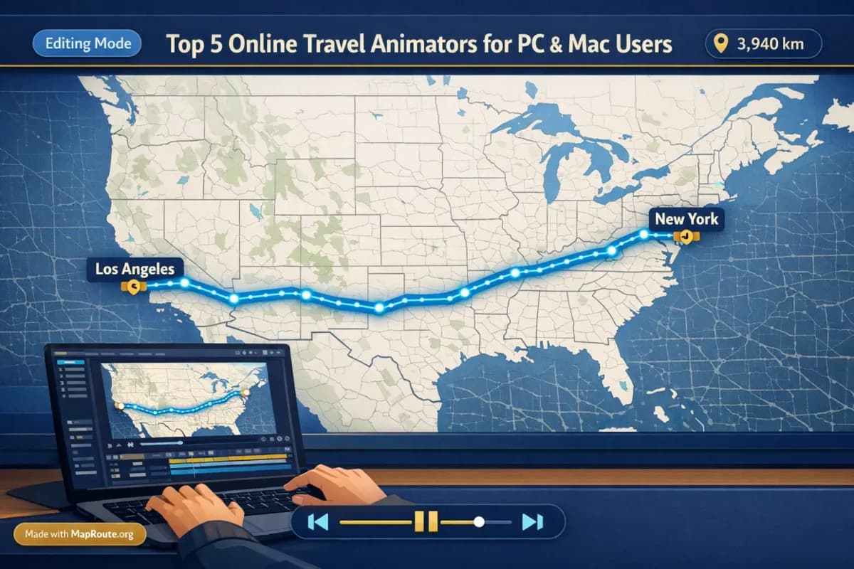
New York to Los Angeles by road: a classic US road trip visual
- Open maproute.org and set your browser window wide enough for a 16:9 frame if you’re planning a YouTube video.
- Search for “New York” as the From location and pick the correct suggestion, then “Los Angeles” as the To location.
- Choose the Road mode and click Generate Journey.
- Let the animation play at 1x to get an 8–28 second clip (exact duration depends on the computed road distance).
- With a verified account, download the video. It will include the moving marker along the road path plus a km tracker labeled as road path km and a “Made with MapRoute.org” watermark.
- Drop the clip into your video editor (Premiere Pro, Final Cut, DaVinci Resolve, CapCut, etc.) on your PC or Mac, then add voiceover, titles, and B-roll of your actual trip.
This works well as an opening shot or a quick recap between vlog segments, and you can speed it up further in your editor if you want a snappier cut.
France to Japan geodesic: a clean geography explainer
- Decide whether this is for vertical or horizontal content. For TikTok or Reels, narrow your browser window or use your phone so Map Route renders in 9:16.
- Set From to “France” and To to “Japan” using the suggestions from the search box.
- Pick Geodesic mode and click Generate Journey. Map Route computes a straight-line geodesic distance and frames the map automatically.
- Play the journey and optionally switch to 2x or 4x speed if you want a faster on-screen movement.
- Export the video with your verified account, then layer it under text like “Distance from France to Japan” in your editor.
- Remember that the km tracker will be labeled as geodesic km. It’s a straight-line distance, usually shorter than any actual road or multi-leg travel path.
If you need a multi-leg story (for example, Paris → Dubai → Tokyo), Map Route can’t combine all legs in one file. Generate each pair separately, then cut the clips together in your editor.
Using online travel animators for TikTok, Reels, and Shorts
For short-form platforms, online travel animators shine because you can stay entirely in the browser and ship fast. The main considerations are aspect ratio, clip length, and how you integrate the map into your narrative.
- Aspect ratio: On Map Route, 9:16 vertical is automatic on phones or narrow windows. For PC and Mac, just drag the browser narrower before generating.
- Clip length: At 1x speed, Map Route journeys are typically around 8–28 seconds depending on distance. For TikTok, Reels, and Shorts, that’s often enough for a standalone route video or a background layer under text.
- Playback speed: You can switch playback to 2x or 4x before capture if you want a more energetic route motion. If you still need it faster, you can speed it up further in your editor.
- Editing: Add captions, trending sounds, and cuts in your usual mobile or desktop editor. Map Route doesn’t handle audio uploads or beat-sync; that all happens after export.
- Branding: Since Map Route exports include a “Made with MapRoute.org” watermark, plan your layout so it doesn’t clash with your own on-screen text or overlays.
Integrating map animations into long-form vlogs on PC and Mac
For vloggers and travel filmmakers, online map animators are usually one step in a bigger pipeline. The map clip becomes a visual anchor that you then surround with voiceover, B-roll, and music in your main editor.
- Plan your route beats: Decide which legs of your trip deserve a map moment (for example, “New York → Los Angeles” or “France → Japan”).
- Generate a separate Map Route clip for each leg in the mode that matches your story (Road, Rail, Air corridor, or Geodesic).
- On PC or Mac, download the animations after verifying your account. Each download counts toward your daily quota.
- Import the clips into your editing software and place them at transitions: before a new city, after a time-lapse, or as a recap.
- Add voiceover to explain what’s happening on the map. Since Map Route doesn’t handle audio, you’ll record and sync everything in your editor.
- If you want titles or labels (for example, “Leg 1: New York → Los Angeles”), create those as text layers in your editor and position them away from the Map Route watermark.
Map Route’s camera and framing are automatic. You can’t set custom camera paths, orbits, or keyframes like in After Effects, so plan your edit around the existing framing rather than trying to match complex camera moves.
How Map Route compares to other travel animation options
Here is a high-level comparison of the same five online tools. Competitor cells stay general because public pricing and export rules change.
| Tool | Where it runs | Best used for | What to verify yourself |
|---|---|---|---|
| Map Route | Browser on PC, Mac, and phones — no install | Fast two-point journeys (road, rail, air corridor, geodesic) with a km tracker | Daily generate/download limits, Made with MapRoute.org watermark, two endpoints per clip |
| Google Earth Studio | Desktop browser (Google product) | Cinematic Earth flyovers and location establishing shots | Account access, current export options, and whether it fits a simple city-pair story |
| Mapimator | Browser on PC and Mac | Online map-studio work: routes, markers, exported video without After Effects | Current plans, watermarks, resolution, and camera-control features on the live site |
| AvoMap | Browser on PC and Mac | Animated route videos from GPX/KML or a drawn route | Segment types, render method, and any paid tiers on avomap.com |
| Anim8map | Web browser | Lightweight pinned-route travel map videos | Free-tier limits, watermark, and browser support on the current product |
After Effects remains the desktop option when you need full keyframe control. TravelBoast remains the well-known phone app. Neither is an online PC/Mac animator, so they sit outside the top five.
Checklist: picking the right online travel animator for your workflow
Before you commit to a tool
- Confirm it runs in a browser you already use on PC or Mac (Chrome, Safari, etc.) so you don’t need extra installs.
- Decide if you mainly need simple two-point journeys (Map Route style) or fully custom multi-stop, keyframed animations (desktop software).
- Check how aspect ratio is controlled and whether you can easily get 9:16 for Shorts/Reels and 16:9 for YouTube.
- Look at export formats and limits: video vs stills, daily quotas, and whether a watermark is included.
- Plan where audio, titles, and B-roll will be added. With Map Route, all of that happens later in your own editor.
- Test a real route you care about, such as New York → Los Angeles by road or France → Japan as a geodesic line, to see how the map is framed.
- If you need multi-leg trips, verify that you’re comfortable stitching multiple two-point clips together in your editor.
- Make sure the tool is honest about what the routes represent (estimated road path, railway alignment, air corridor, or geodesic line) and doesn’t pretend to be a booking engine or live tracker.
FAQ
What are the five online travel animators in this article?
Map Route, Google Earth Studio, Mapimator, AvoMap, and Anim8map. All five can be used from a PC or Mac browser. Map Route is the two-point journey clip with a km tracker. The other four are Earth-camera or map-studio tools — confirm their current plans, watermarks, and export options on each product’s own site.
Does Map Route work on both PC and Mac?
Yes. Map Route runs entirely in your browser, so it works on both PC and Mac as long as you use a modern browser such as Chrome or Safari. There’s no app to install and no desktop plugin.
Can I create multi-stop travel animations online with Map Route?
Not in a single file. Each Map Route generate is exactly two endpoints (From + To). There’s no built-in multi-stop waypoint editor. To show a multi-leg trip, you generate each pair separately (for example, City A → City B, then City B → City C) and combine the clips in your own video editor.
What export formats does Map Route provide?
After you register and verify your email, you can download a browser-captured video of the animation (MP4 with H.264 when supported, otherwise WebM) or export a WebP still image of the current frame. These exports are captures of the player, not guaranteed server-rendered HD files.
Is there a watermark on Map Route downloads?
Yes. All Map Route downloads, both videos and images, include a “Made with MapRoute.org” watermark. There is no watermark-free export option in the current product.
How much does Map Route cost to use?
Map Route is free to use. Logged-out visitors can generate up to 3 journeys but cannot download. With a verified free account, you get 5 combined uses per UTC day across Generate Journey, Download Video, and Export Image. Paid plans exist only as a manual upgrade if you contact the team from your account page.
Can I add music or voiceover directly in Map Route?
No. Map Route focuses on generating the map animation itself and doesn’t handle audio uploads, beat-sync, or voiceover. The recommended workflow is to export the route clip and then add music, narration, titles, and B-roll in your own editing software on PC or Mac.
Does Map Route guarantee worldwide coverage for any route I type?
No. Place search uses Photon with a Nominatim fallback, so you can search many cities, regions, and countries worldwide, but coverage depends on what those public geocoders return. Road routing uses OSRM and rail uses OSM railway geometry when found, so some very remote or complex routes may not resolve. If road or rail geometry can’t be computed, Map Route offers a geodesic line instead.
Is Map Route a booking tool or live flight tracker?
No. Map Route is purely a visualization tool. It shows road paths, railway alignments, estimated air corridors, or geodesic lines to illustrate geography between two places. It is not a booking desk, timetable, ticket, or proof that a specific airline, train, or bus service operates between those locations, and it does not track live flights or ships.