Why animate your Southeast Asia backpacking route?
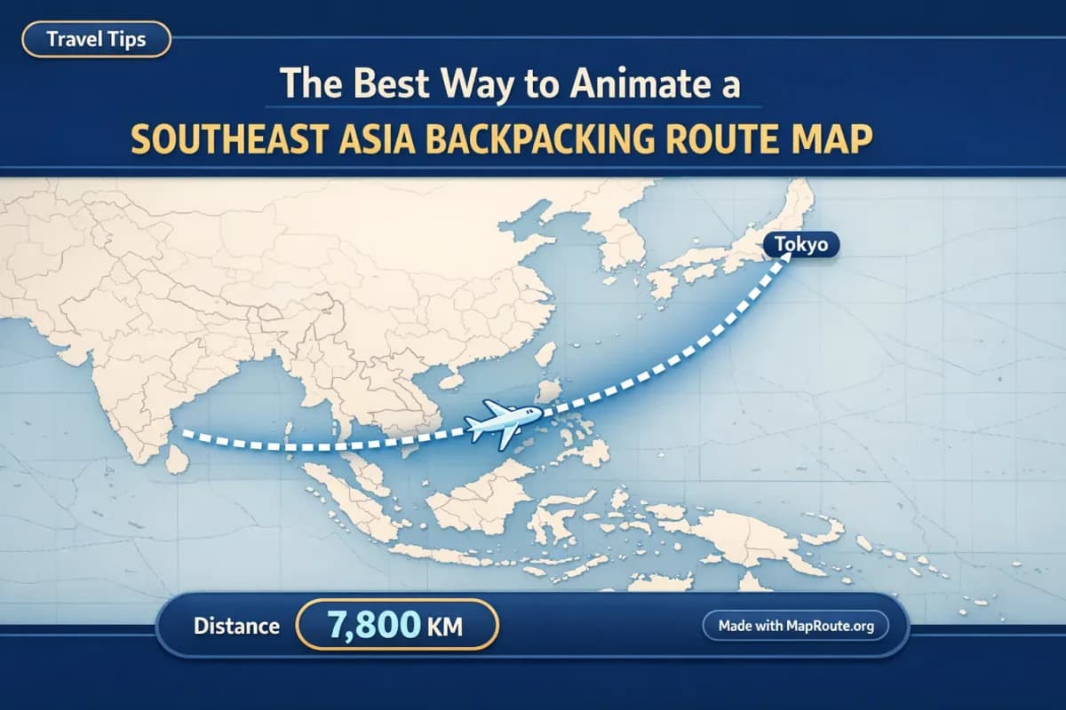
The best way to animate a Southeast Asia backpacking route map is to use a browser-based map animation tool that turns your path between two places into a moving line with a traveling marker. With Map Route, you can do this directly in your browser without installing an app or learning complex video software.
For backpackers, that means you can quickly show your journey from Bangkok to Hanoi, Singapore to Bali, or even a long-haul like Tokyo to Sydney as an animated map clip. Instead of manually keyframing a camera in a desktop editor, Map Route automatically finds an estimated air corridor, road path, rail alignment, or geodesic line between two points and animates a marker along it, complete with a distance counter.
This article walks through how to use that for a Southeast Asia backpacking route: what works perfectly, where you’ll need a workaround for multi-stop trips, and how to shape your clips for TikTok, Reels, Shorts, and YouTube vlogs.
Step-by-step: animating a Southeast Asia backpacking leg
Map Route is built around individual journeys between two places. For a typical backpacking leg—say Bangkok to Siem Reap—you create one clean animation, then combine it with others in your editing app if you want a full trip montage.
- Open Map Route in your browser: Go to maproute.org in a modern browser such as Chrome or Safari. There’s no app to install or plugin to manage.
- Choose your first backpacking leg: In the From box, type at least two characters of your starting point (for example, "Bangkok"). In the To box, do the same for your destination (for example, "Siem Reap"). Suggestions include a label, context (country/region), and a kind badge so you can confirm you picked the right place.
- Pick the visualization mode: For Southeast Asia backpacking, Road is useful when there’s a drivable path, Rail when there’s a railway alignment, Air corridor for flights, and Geodesic for a simple straight-line on the globe. Remember: these are visualizations, not tickets or timetables, and they don’t prove that a specific bus, train, or airline operates that route.
- Generate your journey: Click Generate Journey. Map Route runs through a short prep sequence—resolving places, requesting geometry, framing the map, and preparing the journey. If road or rail geometry can’t be found, the player will say so and offer a geodesic line instead.
- Preview the animation: Use the built-in controls to Play, Pause, and Replay the journey. You can also change speed between 1x, 2x, and 4x. At 1x, most journeys run around 8–28 seconds depending on distance, which is ideal for short-form content.
- Adjust for social orientation: If you’re on a phone or a narrow browser window (under 768px wide), the animation will be 9:16—perfect for TikTok, Instagram Reels, YouTube Shorts, and Stories. On a wider window (from 768px upward), it will be 16:9, which fits YouTube vlogs and landscape intros. There’s no separate aspect ratio picker; it follows your window.
- Create your account to export: You can test Map Route logged out (up to 3 generates), but you’ll need a free, verified account to download images or videos. After registering and verifying your email, you can use Download Video or Export Image. Each generate, download, or export counts toward your 5 daily uses.
- Download your clip or still: Download Video captures what you just watched in your browser as an MP4 (H.264) when supported, or WebM otherwise. Export Image saves a WebP still of the current frame. Both include a visible “Made with MapRoute.org” watermark; there’s no watermark-free export in the current product.
- Repeat for each leg of your route: For a full Southeast Asia backpacking route, generate one clip per pair of places—Bangkok → Siem Reap, Siem Reap → Ho Chi Minh City, Ho Chi Minh City → Da Nang, and so on. Then combine them in your own video editor.
Map Route doesn’t have a multi-stop editor. Each animation is exactly From + To. To show a full backpacking loop, you’ll need to generate each leg separately and stitch the clips together in your own editing software.
What makes Map Route useful for Southeast Asia backpackers?
Backpackers usually care less about cinematic perfection and more about speed, clarity, and being able to post while Wi‑Fi is decent. Map Route’s design leans into that: fast two-point journeys, automatic framing, and a distance counter that gives context to your trip.
Four visualization modes for different kinds of legs
Southeast Asia trips often mix buses, trains, and flights. You can’t combine all of those in a single Map Route journey, but you can pick the mode that best represents each leg:
- Road: Shows a road path from a routing engine. Great for overland legs like Chiang Mai to Pai or Hanoi to Ha Long Bay. It’s not a bus timetable or a guarantee that a specific service runs.
- Rail: Uses railway alignment geometry when available. Handy for showing routes like Bangkok to Surat Thani by train. Long-haul rail may fail if geometry can’t be computed; in that case, you can fall back to a geodesic line.
- Air corridor: Draws an estimated great-circle line between two cities, such as Bangkok to Bali or Tokyo to Sydney. It’s not a filed flight path and doesn’t mean airlines operate that exact pairing.
- Geodesic: A straight-line distance across the globe. Good as a visual when road or rail can’t be found, or when you simply want to highlight “as-the-crow-flies” distance.
Automatic framing and a moving marker
You don’t have to manage a virtual camera. Map Route automatically frames short hops tightly and zooms out for long hauls. A marker or vehicle icon moves along the computed line, and the map may tilt slightly for mid-range distances to add depth (around 22° under roughly 1800 km, about 8° under roughly 5000 km, 0° for very short or very long journeys). You can’t set custom camera paths, orbits, or keyframes; the motion is automatic.
Distance tracking that tells your story
Each animation includes a km tracker that matches the line being drawn—road path km, railway geometry km, air corridor estimate km, or geodesic km. This is the length of the line Map Route computed, not driving time, official train distance, or an airline’s published mileage. Typically, air corridor or geodesic numbers will be shorter than a road path between the same cities, which can be a fun detail to mention in your captions.
Works in your browser, on the road
Because Map Route runs in a browser and doesn’t require installing an app or plugin, you can use it on hostel computers or your own phone. Place search, generate, play, pause, and replay work on both mobile and desktop. Downloading images and videos does require a verified account, and video capture can occasionally fail in some browsers—if that happens, you’ll still be able to view the animation, but you may need to try a different browser or device to capture it.
Example animations for a Southeast Asia backpacking trip
To make this concrete, here’s how you might break down and animate a classic Southeast Asia backpacking route, plus how a longer hop like Tokyo to Sydney fits in.
Overland Southeast Asia loop
Imagine a loop like Bangkok → Siem Reap → Ho Chi Minh City → Da Nang → Hanoi → Luang Prabang → Chiang Mai → Bangkok. In Map Route, this becomes a series of individual journeys:
- Bangkok → Siem Reap (Road mode): Shows the overland path roughly following main highways.
- Siem Reap → Ho Chi Minh City (Road or Geodesic): Use Road if geometry is found; if not, fall back to a geodesic line.
- Ho Chi Minh City → Da Nang (Air corridor or Rail): Use Air corridor to represent a flight, or Rail if a railway alignment is available and you want to emphasize the train journey.
- Da Nang → Hanoi (Rail): Visualize the coastal railway alignment if Map Route can compute it.
- Hanoi → Luang Prabang (Air corridor): A neat arc over the mountains, showing how far you’re jumping.
- Luang Prabang → Chiang Mai (Air corridor or Road): Depending on how you actually traveled, pick the mode that fits best.
- Chiang Mai → Bangkok (Rail or Road): Great for a night train or bus leg.
You’ll export each of these as its own short clip, then join them in your editor so viewers see the entire loop in sequence.
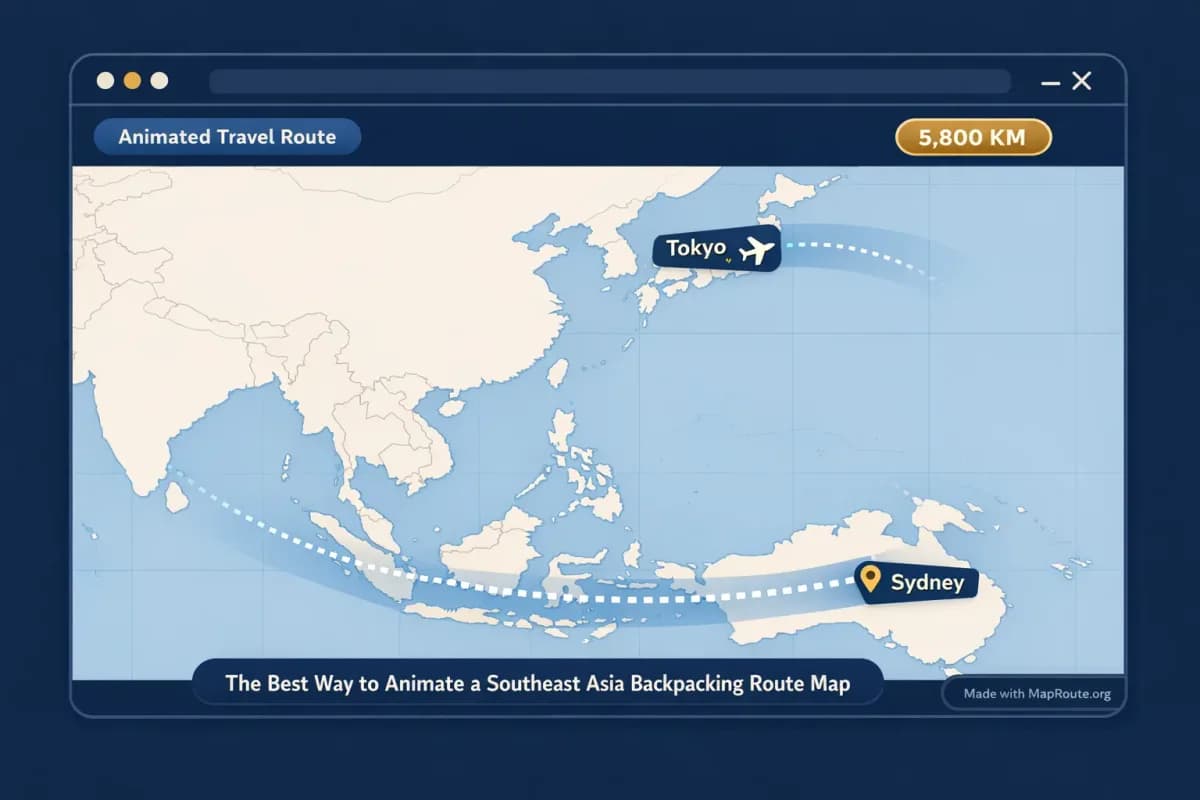
Long-haul example: Tokyo to Sydney by air corridor
Many Southeast Asia backpackers tag on a bigger flight before or after the region. For instance, flying from Tokyo to Sydney after exploring Vietnam and Thailand:
- Set From to "Tokyo" and To to "Sydney".
- Choose Air corridor to get an estimated great-circle line across the Pacific region.
- Generate Journey and watch the marker travel that long arc, with an air corridor km estimate ticking up as it moves.
- On a wide screen, capture this as a 16:9 clip for your YouTube vlog intro. On your phone, capture it vertically for Reels or TikTok to tease the “next chapter” of your trip.
Because Map Route automatically adjusts framing for long distances, you don’t need to worry about the map cutting off parts of the route—it will zoom out enough to keep the entire air corridor in view.
Using Map Route clips in a backpacking vlog
Map Route isn’t a full video editor. It doesn’t handle voiceover, B-roll, transitions, or music sync—but it slots neatly into whatever editing workflow you already use, from simple mobile apps to more advanced desktop tools.
Basic vlog workflow with Map Route
- Generate and download your route clips: One per leg, choosing Road, Rail, Air corridor, or Geodesic as needed.
- Import into your editor: Add the MP4/WebM files to your editing app’s media bin.
- Layer with titles and B-roll: Put the map clip on the timeline, then add text like "Vietnam Week 1: Hanoi to Da Nang". Cut to your street food shots or hostel tours as the marker moves.
- Add voiceover and music: Record narration explaining how you actually traveled (bus, train, budget airline) and add background music. Map Route doesn’t sync to audio, so you’ll adjust timing by trimming or changing the playback speed in your editor.
- Repeat for each segment: Stitch together Bangkok → Siem Reap, Ho Chi Minh City → Da Nang, and Tokyo → Sydney to give viewers a clear sense of the overall journey.
Honest expectations about quality and control
Video exports from Map Route are a capture of what your browser played back, not a guaranteed server-rendered HD export. The quality is generally suitable for YouTube and social media, but if capture fails in your browser you may need to retry or switch browsers. You also can’t fine-tune camera moves or create complex 3D globe spins; the focus is on clean, readable map journeys you can build a story around.
Map Route vs more complex route animation options
If you’ve seen elaborate animated travel maps on YouTube, you might wonder whether you need heavy desktop software or a specialized app to get started. Map Route sits at the simple, browser-based end of the spectrum, which is often exactly what backpackers need on the road.
| Tool type | Setup | Route structure | Camera control | Exports | Best for |
|---|---|---|---|---|---|
| Map Route (browser-based) | Open in a modern browser, no install | Two-point journeys (From + To only), one mode per clip | Automatic framing and simple map pitch; no custom keyframes | Browser capture as MP4/WebM with a “Made with MapRoute.org” watermark | Backpackers and creators who want quick, clear map clips without learning complex software |
| Desktop motion graphics software (e.g., After Effects-style tools) | Install on a computer; steeper learning curve | Flexible: can build multi-stop sequences in one composition | Full control with custom camera paths, 3D layers, and keyframes | High control over resolution and codecs; export depends on project settings | Advanced creators who want highly customized, cinematic map animations and have time to edit |
| Mobile travel-story apps (e.g., route-story apps like TravelBoast-style tools) | Install on a phone; typically app-based workflow | Often support multiple stops inside one project | Predefined camera styles with limited customization | Mobile-friendly video exports with app branding or watermark | Quick social posts from a single device, with map plus stickers or templates |
If you need a single file that shows dozens of stops in one continuous shot, Map Route alone won’t do that. The practical workaround is to generate one clip per leg and assemble them in your own editor so they play back-to-back.
Checklist: before you animate your Southeast Asia route
Before you generate your first journey
- List your key legs as From → To pairs (e.g., Bangkok → Siem Reap, Hanoi → Luang Prabang, Tokyo → Sydney).
- Decide which mode best reflects each leg: Road, Rail, Air corridor, or Geodesic.
- Choose whether you want vertical (phone / narrow window) or landscape (wider window) clips for each platform.
- Create and verify a free Map Route account if you plan to download video or image exports.
- Check you have a modern browser (such as Chrome or Safari) and reasonable connectivity to load map tiles and export.
- Plan where you’ll combine clips—mobile editor, desktop editor, or both—for titles, voiceover, and music.
- Remember that each generate and each download counts toward your daily free usage, so prioritize the legs you most want to show.
With that prep done, animating a Southeast Asia backpacking route becomes a straightforward part of your travel storytelling: one leg, one clean map animation, stitched together into a journey your friends, family, and followers can actually follow.
FAQ
Can I animate my entire Southeast Asia backpacking route in one go?
Not in a single Map Route file. Each Map Route journey is between exactly two endpoints (From + To), with one visualization mode per generate. To show an entire multi-stop backpacking route, you’ll need to generate a separate clip for each leg (for example, Bangkok → Siem Reap, Siem Reap → Ho Chi Minh City) and then combine those clips in your own video editor.
Does Map Route show real bus, train, or flight services in Southeast Asia?
No. Map Route visualizes geography between two places; it is not a booking desk, timetable, ticket, or proof that any bus, train, or airline operates that route. Road mode shows a road path from a routing engine, Rail mode shows railway alignment when geometry is available, Air corridor shows an estimated great-circle line, and Geodesic shows a straight-line distance on the globe.
Is Map Route free to use for my backpacking trip?
Yes, Map Route is free to use. Logged-out visitors can Generate Journey up to 3 times but cannot download images or videos. With a free, verified account, you get 5 combined uses per UTC day—each Generate Journey, Download Video, and Export Image counts as one use. There’s no self-serve checkout; paid plans exist only as a manual upgrade via the account page.
What devices and browsers can I use to animate my route?
Map Route works in modern browsers, including Chrome and Safari, on both phones and desktop computers. You can search places, generate journeys, and play, pause, or replay animations on either. Image and video downloads require a verified account, and in some browsers video capture can fail; if that happens, you may need to try again or switch browsers or devices.
What kind of video and image exports does Map Route provide?
After you register and verify your email, you can use Download Video and Export Image. Download Video saves a capture of the animation you watched in your browser as an MP4 (H.264) when supported, otherwise as WebM. Export Image saves a WebP still of the current frame. Both formats follow the current window aspect ratio (9:16 on narrow windows, 16:9 on wider ones), and all exports include a visible “Made with MapRoute.org” watermark. There is no watermark-free export option.
Does Map Route cover all cities and islands in Southeast Asia?
Map Route relies on public geocoding services (Photon with Nominatim fallback) for place search, and on routing and map data such as OSRM and OpenStreetMap. You can usually search for cities, regions, and countries worldwide as long as those services return results, but coverage is not guaranteed for every village, island, or airport code. If a specific place doesn’t resolve, you may need to choose the nearest recognizable city or region instead.
Can I add music or sync my route animation to a beat inside Map Route?
No. Map Route is not a full video editor and does not support audio upload, music libraries, or beat-sync. Playback speeds are limited to 1x, 2x, and 4x, and the animation duration is based on distance. To add music, voiceover, or sound effects, you’ll download the clip and then handle all audio work in your own editing software.
Will my Southeast Asia route animations look like a 3D globe spin?
Map Route uses a MapLibre map with a light political-style basemap, not a 3D globe export. The homepage may show a decorative globe, but the actual journey player is a 2D map with slight pitch on some distances to add depth. You can’t create custom 3D camera or orbit moves; instead, Map Route automatically frames your route so it’s clear and readable.