How to Make Travel Map Animations Online Without Downloading an App
You can make polished travel map animations entirely in your browser without downloading any app or desktop plugin. Map Route (maproute.org) runs in a modern web browser and turns the geography between two places into a short animated journey clip you can reuse in your travel content.
Whether you want to show London to Paris by rail, Tokyo to Sydney by an estimated air corridor, or any other two-point journey, the whole process stays online: open the site, type your locations, pick a mode, and generate. From there you can download the animation (with a small “Made with MapRoute.org” watermark) and finish your edit in your usual video editor.
This guide walks through the exact steps, explains what Map Route can and cannot do, and shows how to get clips that fit TikTok, Instagram Reels, YouTube Shorts, or landscape YouTube vlogs—all without installing anything.
Step‑by‑step: Create a travel map animation fully online
1. Open Map Route in your browser
Go to maproute.org in a modern browser such as Chrome or Safari. Map Route is entirely browser-based: there is no mobile app to install, no desktop plugin, and no project file to download just to get started.
Reading articles on the Map Route blog and browsing the site never consumes your generation quota.
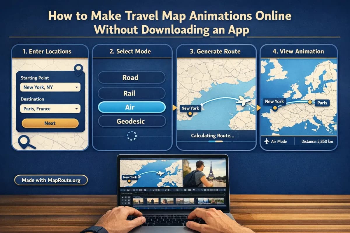
2. Choose your From and To locations
On the Map Route homepage you’ll see two search boxes: From and To. Map Route always works with exactly one pair of endpoints per animation.
- Click or tap in the From box and start typing at least two characters of your departure city, region, or country (for example, “London”).
- Pick the correct suggestion from the dropdown. Each suggestion shows a label, some context, and a small badge indicating the kind of place.
- Repeat the same process in the To box for your destination (for example, “Paris, France” or “Sydney, Australia”).
Place search uses public geocoders (Photon with Nominatim fallback). Coverage is broad, but not every village or code is guaranteed to resolve.
3. Select a visualization mode
Map Route offers four distinct visualization modes. These do not book tickets or guarantee that a particular service exists; they simply visualize geography between your chosen places:
- Road – a typical road path from a routing engine (not a bus service or driving-time estimate).
- Rail – a railway alignment where geometry can be found (not a train ticket or proof that a passenger service operates).
- Air corridor – an estimated great-circle line between the two places (not a filed flight plan or proof airlines fly that route).
- Geodesic – a straight-line distance on the globe (a pure distance visualization, not a travel route).
For example, to show London to Paris by rail for a Eurostar-style segment, you’d select Rail. For Tokyo to Sydney, Air corridor is usually the most intuitive choice.
4. Generate your journey animation
- Click or tap “Generate Journey”.
- Map Route runs through several prep stages: Resolving places → Requesting geometry → Framing the map → Preparing journey.
- If road or rail geometry can’t be computed for your pair, Map Route will say so and offer a geodesic alternative instead.
Once prepared, the player loads with your animated line and a moving marker or vehicle icon. You can Play, Pause, Replay, and change speed between 1x, 2x, and 4x.
5. Adjust speed and framing (indirectly)
Map Route automatically frames the map based on distance. Short hops are zoomed in; long hauls pull back to show more of the globe. A slight pitch is applied on many mid-range distances to give a subtle 3D feel, but you cannot set custom camera paths or keyframes.
Animation duration at 1x is automatically computed from the distance (roughly 8–28 seconds). To match your target edit, you can:
- Switch to 2x or 4x speed for a snappier clip.
- Trim or re-time the clip later in your own video editor.
6. Register to download your clip (no software install)
You can generate up to three journeys while logged out, but downloading images or videos requires a free account with email verification.
- Click Register on maproute.org or create a free account.
- Create your account with a non-disposable email and verify it.
- After verification, sign in and generate your route again if needed.
- Use Download Video to save a browser capture of the animation (MP4 when supported, otherwise WebM).
- Use Export Image to save a WebP still of the current frame and aspect ratio.
All downloads include a small “Made with MapRoute.org” watermark. There is currently no watermark-free export.
Key online features that replace heavy desktop tools
If you’re used to installing plugins or wrestling with keyframes in desktop software, Map Route’s browser workflow is intentionally minimal. It focuses on doing one thing well: animating the geography between two points.
No install, no project files
Because Map Route runs entirely in your browser, you don’t need to download an app, manage updates, or keep track of project files. You simply:
- Open the site in a compatible browser.
- Search your locations and generate.
- Download the resulting clip or image once you’re signed in.
Automatic map style and camera behavior
The animation uses a MapLibre-powered map with an OpenFreeMap light political-style basemap. Framing and pitch are automatic, with date-line-safe paths and a moving marker that follows the computed line. There is no 3D globe renderer and no manual camera control, which keeps the interface simple and fast for non-specialists.
Distance-aware timing and km tracker
Map Route shows a km tracker that matches the line it actually computed. Labels distinguish between road path km, railway geometry km, air corridor estimate km, or geodesic km. This is not driving time, ticket distance, or an airline’s official mileage; it is a visual metric for your animation.
The base duration at 1x is derived from that distance, then you can speed it up to 2x or 4x. This makes it easy to produce short, punchy clips suitable for social media without tweaking dozens of settings.
Aspect ratio that adapts to your device
There is no aspect ratio picker in Map Route. Instead, the player and exports follow your browser window’s width:
- Below 768px wide (phones or narrow windows): 9:16 vertical, ideal for TikTok, Instagram Reels, Instagram Stories, and YouTube Shorts.
- From 768px wide upward: 16:9 landscape, suitable for YouTube intros and horizontal travel vlogs.
To control the final aspect, simply generate and capture your journey on a device or window size that matches the format you need.
Practical examples: from London–Paris rail to Tokyo–Sydney air
Example 1: London to Paris by rail
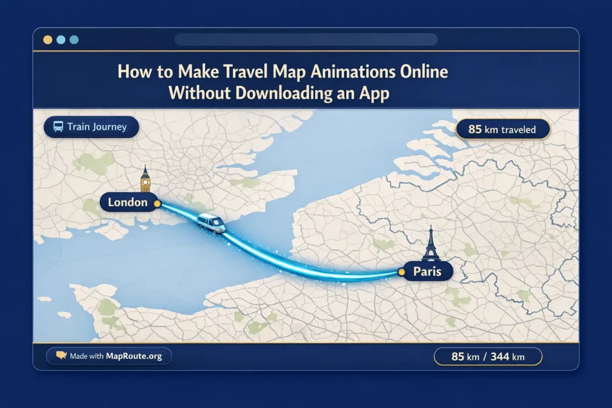
Imagine you’re editing a vlog of a London to Paris rail trip and you want a simple animation that shows your cross-Channel journey.
- Open maproute.org on your laptop with the browser window wider than 768px to get a 16:9 landscape clip.
- Set From to “London, United Kingdom” and To to “Paris, France”.
- Choose Rail as the mode, then Generate Journey.
- Once the railway alignment is computed and the animation loads, preview it at 1x or 2x speed.
- Register and verify your account if you haven’t already, then Download Video.
- Import the clip into your video editor and place it between your London and Paris B-roll shots.
Rail mode visualizes railway geometry where available; it is not proof of a specific train service or timetable.
Example 2: Tokyo to Sydney by estimated air corridor
For a long-haul flight vlog, you might want to show an arc across the map from Japan to Australia.
- On your phone, open maproute.org in a vertical orientation so the window is under 768px wide (perfect for 9:16).
- Set From to “Tokyo, Japan” and To to “Sydney, Australia”.
- Select Air corridor as the mode and tap Generate Journey.
- Preview the estimated great-circle line at 1x speed; this will usually be toward the upper end of the 8–28 second range.
- After signing in with a verified account, tap Download Video to capture the animation as a vertical clip.
- Use this clip at the start of your TikTok or Reel to show the jump from Tokyo to Sydney.
The air corridor is an estimated great-circle path, not a live flight tracker or proof that airlines operate that city pair.
Handling multi-leg trips entirely online
If your trip has multiple stops—say London → Paris → Milan—you cannot animate all three in one Map Route file. The tool only supports one From + To pair per generate and there is no multi-stop waypoint editor.
The practical workaround is straightforward:
- Generate and download London → Paris.
- Generate and download Paris → Milan.
- Combine the two clips in your usual editing software, adding transitions, text labels, and music there.
Using browser-made map animations in your travel vlogs
Map Route is intentionally not a full video editor. It doesn’t add voiceovers, B-roll, or music; instead, it gives you a clean, focused map clip you can drop into the editing setup you already use.
Add voiceover, music, and titles in your own editor
After downloading your animation, import it into your preferred editing software. This is where you can:
- Record or sync voiceover explaining the journey.
- Add background music and align cuts to the beat.
- Overlay text labels (e.g., “London → Paris by rail”).
- Insert B-roll clips before and after the map animation.
Map Route does not support audio upload, beat sync, or soundtrack matching. All audio work happens in your external editor.
Building a consistent style without extra software
Because the map style and animation behavior are consistent across routes, you can generate multiple segments—such as each leg of a longer backpacking trip—and then combine them into a series. You still never have to install a dedicated animation app; you just visit the website, generate, and download each clip.
Browser-based Map Route vs traditional animation tools
If you’ve seen animated travel lines in big-budget productions, you might wonder how a browser tool compares with heavyweight desktop software or mobile apps. The trade-offs mostly come down to control vs. speed and the need (or not) to install extra software.
| Tool type | Install required? | Complexity | Camera control | Export notes |
|---|---|---|---|---|
| Map Route (browser-based) | No – runs in a modern web browser | Simple – From/To and mode selection | Automatic framing and pitch, no custom keyframes | Browser capture video (MP4 or WebM) and WebP image with “Made with MapRoute.org” watermark |
| Desktop motion graphics software (e.g., After Effects) | Yes – full desktop installation | Advanced – keyframes, plugins, manual map setup | Full manual control with keyframes and effects | High flexibility, but requires more setup and expertise |
| Mobile travel animation apps (e.g., popular route-story apps) | Yes – mobile app download from a store | Varies – typically guided templates | Template-based, usually less granular than desktop tools | Exports depend on the app; watermark and formats vary |
If you need fine-grained camera moves, orbit shots, or completely custom map styling, a desktop motion graphics tool is still the way to go. If your priority is to stay online, avoid downloads, and quickly visualize a journey between two places, Map Route’s browser workflow is the more direct option.
Quick checklist for making map animations online without downloads
Before you generate your route
- Decide which two places you want to show (e.g., London → Paris, Tokyo → Sydney).
- Choose the most appropriate mode: Road, Rail, Air corridor, or Geodesic.
- Decide whether you need vertical (9:16) or landscape (16:9) output and size your browser window or device accordingly.
- Confirm you have a modern browser (Chrome, Safari, etc.) ready to use.
While using Map Route in your browser
- Open maproute.org and enter your From and To locations.
- Select your visualization mode and click Generate Journey.
- Preview the animation at 1x, 2x, or 4x speed and note the km tracker label.
- Use Copy link if you want to regenerate the same pair later.
When exporting and editing
- Register and verify your account to unlock Download Video and Export Image.
- Download the browser-captured video (MP4 when supported, otherwise WebM) or a WebP still.
- Remember that all exports include a “Made with MapRoute.org” watermark.
- Import the clip into your editor to add titles, B-roll, voiceover, and music.
FAQ
Do I need to download an app to use Map Route?
No. Map Route is fully browser-based and runs on maproute.org in a modern web browser. There is no mobile app or desktop plugin to install. You create and preview your travel map animations entirely online.
Can I export videos without a watermark?
Not at the moment. All video and image downloads from Map Route include a small “Made with MapRoute.org” watermark. There is currently no watermark-free export option.
How many routes can I generate for free?
Logged-out visitors can generate up to 3 journeys but cannot download images or videos. With a verified free account, you get 5 combined uses per UTC day—each Generate Journey, Download Video, or Export Image counts as one use. The quota resets the next UTC day.
What devices and browsers does Map Route support?
Map Route works on phones and desktop in modern browsers, including Chrome and Safari in typical use. Place search, generate, play, pause, and replay all work on both. Video capture may fail in some browser configurations; when that happens, the player still works and shows a notice.
What video format does Map Route export?
Download Video captures the animation you see in the browser player as an MP4 (H.264) when your browser supports it, otherwise as a WebM file. It is a browser capture rather than a guaranteed server-rendered HD export. Export Image saves a WebP still of the current player aspect.
Can I create multi-stop routes in one animation?
No. Each Map Route generate uses exactly one From and one To location. There is no multi-stop waypoint editor and you cannot combine plane, train, and road in a single Map Route file. For multi-leg trips, generate each pair separately and combine the resulting clips in your own video editor.
Does Map Route work worldwide?
You can search cities, regions, and countries as far as Map Route’s public geocoders (Photon with Nominatim fallback) return results. Coverage is broad, but not every village, landmark, or airport code is guaranteed to resolve, and some road or rail geometries may not be computable.
Can I add music or voiceover directly in Map Route?
No. Map Route focuses on generating the animated map journey only. There is no audio upload, beat sync, or soundtrack matching. To add music, voiceover, or other edits, download your clip and use your preferred video editor.