Turn island-hopping and cruises into map animations
You can absolutely create a cruise‑style or island‑hopping travel animation, but Map Route doesn’t have a literal “cruise ship” or “ferry” mode. Instead, you’ll use air corridor or geodesic lines to trace your path over the sea, then combine those clips into a cruise narrative in your editor.
For travelers, that means you can show the sweep of an Aegean island loop, a Pacific crossing, or a coastal voyage as a clean animated line between two points. This guide walks you through how to do that in the browser with Map Route, how to handle multi‑stop island chains, and how to shape the final video for TikTok, Reels, Shorts, or a YouTube trip report. We’ll use long‑distance examples like Tokyo to Sydney by air corridor and France to Japan as a geodesic line so you can see what’s possible over open ocean.
Map Route visualizes geography between two places; it is not a cruise planner, timetable, ticket, or proof that a ship or ferry operates on that route.
Step‑by‑step: build a cruise‑style route animation in your browser
1. Open Map Route in a modern browser
There’s nothing to install. Open maproute.org in a modern browser (Chrome, Safari, and similar are supported in typical use) on your phone or desktop. Map Route is fully browser‑based, so you’ll do everything—from searching destinations to exporting your animation—inside that tab.
Aspect ratio follows the window size automatically: a narrow phone or narrow desktop window gives you a vertical 9:16 frame (ideal for TikTok, Instagram Reels, YouTube Shorts, and Stories), while a wider window gives you 16:9 for YouTube‑style landscape clips.
2. Choose the two endpoints of your sea journey
Each Map Route animation is a single journey between exactly two places: a From and a To. There is no built‑in multi‑stop editor, so for a cruise or island‑hopping trip you’ll generate a separate clip for each leg and then stitch them together in your own video editor.
- In the From box, start typing the name of your departure port, island, city, region, or country (at least two characters).
- Pick the correct suggestion from the list, using the label and context to distinguish similar names.
- Do the same in the To box for your arrival stop.
Place search uses Photon with Nominatim fallback, so you can look up cities, regions, and countries worldwide as long as those public geocoders return results. It’s not guaranteed that every small island or harbor will resolve by name, but you can often choose the nearest town, region, or country coastline instead.
3. Pick a mode that works over water
Map Route doesn’t have a cruise or ferry mode. To visualize sea crossings, you’ll choose between:
- Air corridor: an estimated great‑circle line that behaves like a long‑haul flight path. This works well visually for open‑ocean crossings and coastal hops, even though it’s not a filed flight or a ship route.
- Geodesic: a straight‑line distance on the globe, purely geometric. It’s good when you want a very direct, clean line and don’t care about following any real transport pattern.
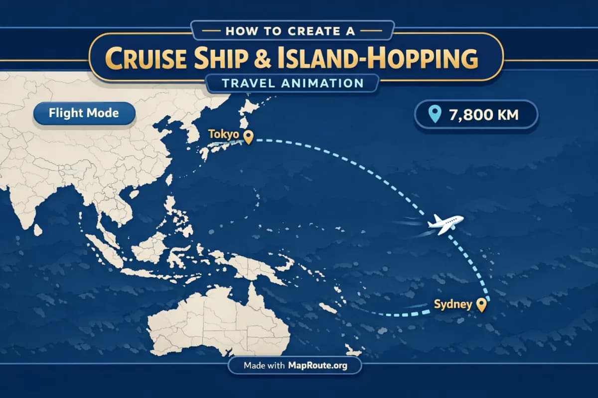
For example, to show a big blue‑water segment of a world cruise, you could set From: Tokyo, To: Sydney, then choose Air corridor. To show a dramatic continent‑to‑continent stretch, you could set From: France, To: Japan, and choose Geodesic for a pure great‑circle line.
Road and Rail modes use land routing and railway geometry. They’re great for overland segments but not for sea crossings, and Map Route won’t compute a literal ferry or cruise path.
4. Generate and preview your journey
Click Generate Journey. Map Route walks through a short prep flow—resolving places, requesting geometry, framing the map, and preparing the journey. If geometry comes back quickly, the last stage may flash by.
Once the player appears, you’ll see a moving marker or vehicle icon following the computed line, with a km tracker that shows the length of that line (air corridor estimate km or geodesic km for sea‑style modes). This distance is purely geometric; it’s not sailing time, ticket distance, or a cruise line’s official mileage.
5. Adjust playback speed and framing (indirectly)
You can control how the animation feels in two main ways:
- Playback speed: use the player controls to switch between 1x, 2x, and 4x. At 1x, most journeys are roughly 8–28 seconds, depending on distance. 2x and 4x are useful if you’re cutting a quick social clip.
- Framing via distance: Map Route auto‑frames based on distance. Short island hops are framed more tightly; long ocean stretches are zoomed out. There’s a slight map pitch on some distances, but you can’t set custom camera paths, orbit moves, or keyframes.
If you want a vertical cruise‑story look, resize your browser window to a narrow shape or use your phone in portrait before you generate and play the journey. The eventual export will match that aspect.
6. Export your clip or still image
To download your cruise‑style animation, you need a verified Map Route account. Registration is free; temporary or disposable emails aren’t allowed, and unverified accounts can’t log in, generate, or download.
- Logged‑out visitors can generate up to 3 journeys but can’t download images or videos.
- With a verified free account, you get 5 combined uses per UTC day. Each Generate Journey, Download Video, or Export Image counts as one use. The quota resets the next UTC day.
After you’ve generated your route:
- Download Video: captures the animation you watched in your browser, including the km tracker, as an MP4 (H.264) when supported by your browser, otherwise WebM.
- Export Image: saves a WebP still of the current frame and aspect ratio.
All downloads include a “Made with MapRoute.org” watermark. There is currently no watermark‑free export, and video capture can fail in some browsers even though playback still works.
What Map Route can (and can’t) do for cruise and island‑hopping stories
When you’re planning to show a chain of islands or a long sea crossing, it helps to understand exactly what Map Route offers and where you’ll need an external editor.
Four visualization modes for different legs
- Road: follows a typical road path from a routing engine. Use this for road‑trip days to and from ports, not for the cruise itself.
- Rail: follows railway alignment where geometry is available. Great for pre‑ or post‑cruise train journeys, but long hauls can fail if railway geometry can’t be computed.
- Air corridor: estimated great‑circle line, ideal for long stretches over water or sky. It’s not a filed flight, but it gives the right sweeping feel between continents or distant islands.
- Geodesic: a straight‑line distance on the globe, good for clean, minimalist visuals or when road/rail geometry isn’t available.
If road or rail geometry can’t be computed for a particular pair, the player will say so and offer a geodesic line instead. That’s often fine for sea days where you mainly want the sense of distance.
Automatic camera and distance‑based timing
Map Route isn’t a 3D globe editor, but it does provide a smooth, automatic camera path:
- The map is a MapLibre map with a light, political‑style basemap from OpenFreeMap / OpenStreetMap.
- Framing is automatic based on distance; very short or very long legs are flatter, mid‑range legs may have a slight pitch (around 22° under ~1800 km, around 8° under ~5000 km).
- The animation duration at 1x is computed from distance using an internal formula and clamped to roughly 8–28 seconds, so you get consistent pacing across your trip.
You can’t keyframe camera moves, orbit around islands, or sync the animation to beats inside Map Route. Those effects belong in your external video editor, using the exported clip as a base layer.
Two‑point journeys only (and how to work around it)
A cruise or island‑hopping trip is naturally multi‑stop. Map Route, however, only generates one leg at a time between two endpoints. There is no internal multi‑stop editor, and you can’t combine plane + train + road + sea modes into a single Map Route file.
The workaround is straightforward: generate each leg separately—for example, Island A → Island B, Island B → Island C, Tokyo → Sydney, Sydney → Auckland—then join those clips in your editing software. This actually gives you more control, because you can decide how long each leg stays on screen and what music or voiceover plays under it.
Example cruise‑style and island‑hopping routes to try
Here are some concrete examples that show how Map Route behaves over water and across long distances. Use them as templates for your own cruise or island‑hopping plans.
Tokyo to Sydney by air corridor: a Pacific sea‑day feel
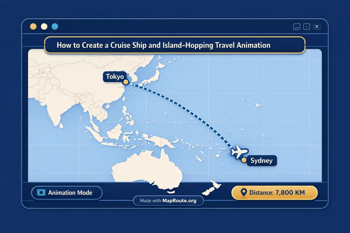
Set From: Tokyo, To: Sydney, and choose Air corridor. The animation will draw an estimated great‑circle line across the Pacific. Even though it’s technically a flight‑style visualization, it also works well as a stand‑in for a long sea crossing on a world cruise or repositioning voyage. The km tracker will show the air corridor estimate, giving your viewers a sense of just how far you’ve traveled between ports.
If you’re making a vlog, you could place this clip over B‑roll of sea days—sunsets from the deck, onboard activities—and explain that this is the distance covered between your last port and Australia.
France to Japan geodesic: a full‑globe arc
Set From: France, To: Japan, and choose Geodesic. You’ll get a clean, straight‑line representation of the shortest distance between Western Europe and East Asia. This is perfect for an opening or closing shot of a long cruise or overland‑plus‑sea adventure, summarizing the journey in a single sweeping arc.
Because it’s a geometric line, it doesn’t claim to follow any specific ship route or airline path. It’s a visual shorthand for “we went a very long way.”
Building an island‑hopping sequence leg by leg
For a multi‑island trip—say, hopping between three or four Greek islands—you’ll create a series of short legs. For example:
- Generate Island 1 → Island 2 (Air corridor or Geodesic).
- Generate Island 2 → Island 3.
- Generate Island 3 → Island 4.
Each leg will be auto‑framed relatively tightly because the distances are short, giving a more intimate sense of hopping from island to island. Export each clip, then line them up back‑to‑back in your editor with crossfades or quick cuts between them to create a smooth, continuous island‑hopping animation.
Map Route’s Explore page offers curated example pairs you can regenerate, but it’s not a social feed and doesn’t contain user‑uploaded cruises or island itineraries.
Using Map Route in cruise vlogs and island‑hopping trip reports
If you’re a travel vlogger, Map Route works best as a map layer you cut into your story. It’s not a full video editor, but it gives you visually consistent route clips that make your cruise or island‑hopping narrative easier to follow.
Where to place route animations in your videos
- Openers: start a cruise vlog with a geodesic or air corridor shot of the biggest jump (for example, France → Japan or Tokyo → Sydney) to set the scale of the journey.
- Segment intros: before each port or island segment, show the short leg you just completed, with a quick voiceover explaining the distance and direction.
- Recaps: at the end of a series, cut together all your legs in order to recap the full route.
Editing tips for smoother cruise narratives
- Match B‑roll: overlay the animation on top of drone shots, deck views, or port arrivals with partial transparency, or cut between them.
- Use the km tracker: call out big distances (“We covered over 7,000 km between these two ports”) to give your audience context.
- Combine modes: use Road or Rail for pre‑ and post‑cruise segments (hotel to port, train to departure city), and Air corridor or Geodesic for the sea days.
There is no built‑in titles, voiceover, B‑roll, or cuts in Map Route. All storytelling elements are added in your preferred video editor after you export the animation.
Map Route vs other ways to show cruise routes
You might be wondering how Map Route compares to heavier tools like Adobe After Effects or mobile apps that create travel lines. Here’s a high‑level comparison focused on cruise and island‑hopping use cases.
| Tool | Setup & Platform | Route Input Style | Camera & 3D Control | Export & Watermark | Best For |
|---|---|---|---|---|---|
| Map Route | Browser‑based; no install; works on phones and desktop | From + To only; four modes (Road, Rail, Air corridor, Geodesic); one leg per generate | Automatic framing and slight pitch; no custom keyframes or 3D globe export | Browser capture as MP4/WebM or WebP image; includes “Made with MapRoute.org” watermark | Travelers and creators who want quick, clean route animations to edit into vlogs or social clips |
| Adobe After Effects (with map plugins) | Desktop software; paid; steeper learning curve | Often manual path drawing or plugin‑based routes; multi‑segment timelines | Detailed control over camera moves, keyframes, and 3D compositions | High‑control exports; watermark depends on license and plugins | Professional editors needing custom camera paths, full branding control, and complex motion design |
| Mobile travel‑animation apps (e.g., phone‑only line animators) | Mobile app install; often freemium with in‑app purchases | Tap‑to‑add multiple waypoints on a stylized map or background | Simple 2D animations; limited or no true camera control | Varies by app; some offer watermark removal for a fee | Casual social posts where quick multi‑stop sketches matter more than geographic accuracy |
For accurate geography between two real places—especially over long sea distances—Map Route gives you an easy, browser‑based workflow. For complex, branded cruise explainers with custom camera moves, you may still want to combine Map Route exports with a desktop editor or motion‑graphics tool.
Checklist for your next cruise or island‑hopping animation
Before you generate your routes
- List every major leg of your cruise or island‑hopping trip (each pair of ports or islands).
- Decide which legs should be Road, Rail, Air corridor, or Geodesic.
- Choose where you’ll publish (TikTok/Reels/Shorts vs YouTube) so you know whether to work in vertical or landscape.
- Make sure you’re using a modern browser and, if you plan to download, that you have or can create a verified Map Route account.
While using Map Route
- Search for each From and To location; if a small island doesn’t resolve, pick the nearest town, region, or country coastline.
- Generate each leg separately; remember there is no built‑in multi‑stop editor.
- Experiment with Air corridor and Geodesic for sea crossings to see which visual you prefer.
- Adjust playback speed (1x, 2x, 4x) and window shape (vertical vs landscape) before exporting.
After exporting
- Import all route clips into your video editor in the order of your trip.
- Trim or speed‑ramp clips to match your music and narration.
- Overlay the animations with cruise and island B‑roll, keeping the “Made with MapRoute.org” watermark visible.
- Render platform‑specific versions (vertical for short‑form, landscape for long‑form) and share your finished cruise or island‑hopping story.
FAQ
Can Map Route show an actual cruise ship or ferry route?
No. Map Route does not have a cruise‑ship, ferry, or bus‑service mode, and it doesn’t know about shipping timetables or operating lines. To represent sea crossings, you’ll typically use the Air corridor or Geodesic modes, which draw an estimated great‑circle or straight‑line path between two places. These lines are visualizations of geography, not proof that a ship operates on that route.
How do I create a multi‑stop island‑hopping animation if Map Route only supports two points?
Map Route generates one journey at a time between exactly two endpoints (From + To). There is no built‑in multi‑stop waypoint editor. To show an island‑hopping or cruise itinerary, you generate each leg separately—Island A → Island B, Island B → Island C, and so on—export each animation, then combine the clips in your own video editor.
What devices and browsers can I use to make these animations?
Map Route works in modern browsers, including Chrome and Safari in typical use, on both phones and desktop computers. Place search, route generation, and playback work on both. Video and image downloads require a registered and verified account, and video capture can fail in some browsers even when playback works; if that happens, the player shows a notice.
Is there a watermark on exported cruise and island‑hopping animations?
Yes. All downloads from Map Route—both video and image—include a “Made with MapRoute.org” watermark. There is currently no watermark‑free export option. If you need additional branding, you can overlay your own text or graphics in your video editor while keeping the watermark intact.
Does Map Route guarantee coverage for every island or port worldwide?
No. Place search in Map Route uses Photon with a Nominatim fallback, which covers many cities, regions, and countries worldwide, but it does not guarantee coverage for every village, small island, or specific port. If a location doesn’t resolve, you can usually pick the nearest recognizable town, region, or country coastline instead.
Is the distance shown accurate for cruise itineraries?
The distance Map Route shows is the length of the line it actually computed—the road path km, railway geometry km, air corridor estimate km, or geodesic km. For cruise‑style legs, you’ll typically see air corridor estimate km or geodesic km. These are geometric distances, not sailing time, ticket distance, or a cruise line’s official mileage.
Is Map Route free to use for travel and cruise animations?
Yes. Map Route is free to use and there is no self‑serve checkout. Logged‑out visitors can generate up to 3 journeys but cannot download images or videos. With a verified free account, you can perform 5 combined actions per UTC day (Generate Journey, Download Video, and Export Image each count as one). Paid plans exist only as a manual upgrade, arranged directly with the team from the account page.
Can I add music, voiceover, or sync the animation to beats inside Map Route?
No. Map Route is not a full video editor and does not support audio upload, music, voiceover, or beat‑sync. It provides the animated map clip (with basic playback speeds of 1x, 2x, and 4x). To add soundtracks, narration, titles, and B‑roll, download the clip and edit it in your preferred video or social‑media editor.