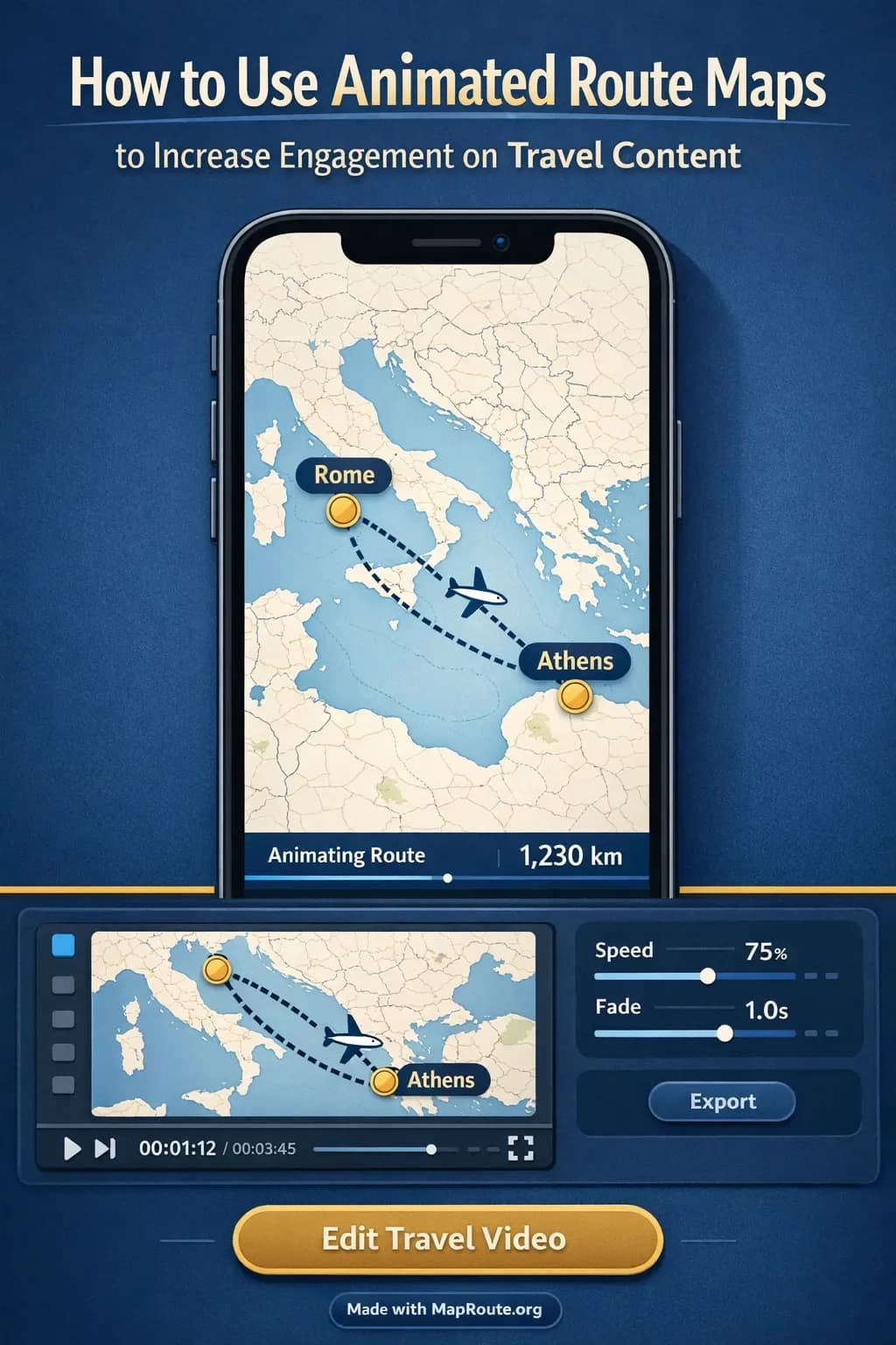
Why animated route maps work so well for travel content
Animated route maps increase engagement on travel content because they make your journey instantly understandable and visually satisfying. They help viewers see where you’re going, how far you’re traveling, and what kind of route you’re taking, all in a few seconds.
Instead of dropping your audience into random clips of trains, planes, and roads, a simple moving line on a map gives them context. It answers questions like “Where is this?” and “How long is this trip?” so they can relax and enjoy the story. In this guide, you’ll learn how to plan, create, and use animated route maps—using a browser-based tool like Map Route—to make your travel videos, reels, and posts more watchable and shareable.
You don’t need motion graphics skills or desktop plugins to do this. With Map Route, you open a browser, pick two places (for example, Paris to Lyon by rail or New York to Los Angeles by road), generate a short animation, download it, and then finish your edit in your usual video or social app.
Map Route visualizes geography between two places; it’s not a booking tool, timetable, or proof that a specific train, bus, or flight operates that route.
Step-by-step: creating an animated route map for your next trip
Here’s a practical workflow to go from idea to finished animated map clip you can drop into your travel content.
1. Decide what story your route needs to tell
Start by deciding where in your content the viewer will need orientation. Some common use cases:
- Opening a vlog: “Today we’re going from Paris to Lyon by rail.”
- Transitioning between locations: “We’re driving from New York to Los Angeles over the next week.”
- Summarizing a leg of a longer journey: “This was our cross-country drive—here’s the route.”
- Clarifying geography: when your audience might not know where a city or region is.
For each moment, you usually only need one clear route: a single rail journey, a road trip segment, or a flight corridor. Map Route is built around this idea of a single From and To pair per animation.
2. Open Map Route in your browser
Go to maproute.org in a modern browser like Chrome or Safari. There’s nothing to install—Map Route is fully browser-based.
If you just want to experiment, you can generate up to three journeys while logged out. To download video or images, you’ll need a free registered account with email verification.
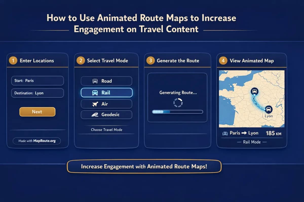
3. Enter your From and To locations
On the Map Route homepage:
- Click into the From field and start typing at least two characters (for example, “Paris”).
- Pick the correct suggestion based on the label and context (city, region, or country).
- Repeat for the To field (for example, “Lyon”).
Map Route uses public geocoders (Photon with a Nominatim fallback) to resolve places, so you can usually search cities and many regions worldwide, as long as those services return a result. It does not guarantee coverage for every village or specific code.
4. Choose the visualization mode that matches your trip
You can pick one of four modes for each journey:
- Road – A road path from a routing engine, good for drives like New York to Los Angeles by road.
- Rail – A railway alignment where geometry is available, ideal for rail content like Paris to Lyon by rail.
- Air corridor – An estimated great-circle style line for flights (not a live tracker or filed flight plan).
- Geodesic – A straight-line distance on the globe, useful when you just want to show “as-the-crow-flies” distance.
If road or rail geometry can’t be computed between your chosen places, Map Route will say so and offer a geodesic line instead.
5. Generate and preview your animated journey
- Click Generate Journey.
- Watch the prep stages: Resolving places → Requesting geometry → Framing the map → Preparing journey.
- Once ready, hit Play to watch the marker move along the route.
The camera framing is automatic. Short hops are framed tightly around the route; long hauls are zoomed out so the full journey is visible. On some distances, a slight pitch is applied to add depth, but you can’t manually keyframe or orbit the camera.
6. Adjust speed and pick the right aspect ratio for your platform
Map Route offers three playback speeds: 1x, 2x, and 4x. The base duration at 1x is usually around 8–28 seconds, depending on distance. For quick social intros, 1x or 2x often works best; 4x is useful if you’re dropping the animation into a longer montage and just need a fast orientation moment.
Aspect ratio is based on your browser window width, not a separate export setting:
- Below 768px wide (phone or narrow desktop window): vertical 9:16, ideal for TikTok, Instagram Reels, YouTube Shorts, and Stories.
- 768px and above: landscape 16:9, ideal for YouTube vlogs and widescreen travel films.
If you want a vertical map for Reels, generate it on your phone or narrow the desktop browser window before exporting. For a YouTube intro, keep the window wide so it exports in 16:9.
7. Download the animation and finish your edit elsewhere
After registering and verifying your free account, you can:
- Use Download Video to save a browser capture of the animation as MP4 (H.264) when supported, or WebM otherwise.
- Use Export Image to save a WebP still frame of the current view.
All downloads include a “Made with MapRoute.org” watermark. There is no watermark-free export in the current product.
The downloaded video is exactly what you saw in the player, including the km tracker. It’s not a separate server-rendered HD export. Occasionally, capture can fail in some browsers; in that case the player still works, but you’ll see a notice.
From here, import the clip into your usual editor (CapCut, Premiere Pro, Final Cut, DaVinci Resolve, VN, etc.) to add music, titles, voiceover, and B-roll. Map Route itself is not a full video editor and doesn’t handle audio sync.
Key Map Route features that help boost engagement
For creators, the value of a tool like Map Route isn’t just that it draws a line on a map—it’s how quickly you can go from idea to usable clip without derailing your editing flow.
Two-point journeys that stay focused on the story
Each Map Route animation is built around a single From and To pair. There’s no multi-stop waypoint editor and you can’t combine plane + train + road in one file. That might sound limiting, but it’s actually a storytelling advantage: it forces you to break your trip into clear, understandable legs.
- “Paris → Lyon” as a dedicated rail segment.
- “New York → Los Angeles” as a long road path.
- “Home city → first stop” as an air corridor to open a series.
For multi-leg trips, you generate each leg separately and combine the clips in your editor. This keeps each map clean and prevents viewers from getting lost in a tangle of lines.
Automatic camera framing and km tracker
Map Route handles the map framing for you. Short distances are shown up close; long distances zoom out to keep the route in view. A marker or vehicle icon moves along the computed line, and a km tracker shows how long that path is, labeled according to mode—for example, road path km, railway geometry km, air corridor estimate km, or geodesic km.
This km figure is the length of the line Map Route computed, not the official driving time, ticket distance, or airline mileage. For engagement, that nuance often doesn’t matter—what matters is that viewers get a sense of scale: is this a short hop, a regional train ride, or a massive cross-country drive?
Works on both phone and desktop
Because Map Route runs in the browser, you can:
- Draft quick vertical maps on your phone while traveling.
- Build longer landscape sequences on your laptop for YouTube.
- Use the same account to generate, download, and edit across devices.
Place search, generate, play, pause, and replay all work on both mobile and desktop. Downloading images and videos requires a verified account, but otherwise the core experience is consistent.
Practical examples: how to use route maps in different formats
Example 1: Paris to Lyon by rail – a clean vlog opener
Imagine a day-in-the-life rail vlog: you’re taking the train from Paris to Lyon. Here’s how you could use an animated route map to hook viewers and keep them oriented.
- In Map Route, set From: Paris, To: Lyon, and choose Rail mode.
- Generate the journey and watch the rail alignment animate between the cities.
- On your phone in portrait or a narrow desktop window, export a 9:16 clip.
- In your editor, place the map at the start of the vlog with a short voiceover: “Today we’re taking the train from Paris down to Lyon—it’s about this far.”
- Cut from the map straight into station B-roll and onboard shots.
This simple 8–20 second clip sets expectations immediately. Viewers know where you’re going, roughly how long the journey is, and that the rest of the video will be about this specific leg.
Example 2: New York to Los Angeles by road – summarizing a road trip
For a cross-country road trip, you might have several episodes or reels. A single animated map can act as a chapter marker or recap.
- In Map Route, set From: New York, To: Los Angeles, and choose Road mode.
- Generate the journey to get a road path across the United States.
- Export a 16:9 clip on desktop for your main YouTube series.
- Use the clip at the start of each episode, pausing it in your editor at different points and overlaying text like “Day 3: Somewhere in the Midwest”.
- For Instagram Reels, regenerate or re-export in 9:16 and use it as a quick teaser: “Driving coast to coast—here’s the route.”
You can’t add intermediate waypoints inside Map Route itself, but you can simulate progress by cutting to different still frames or partial overlays in your editor. The road path and km tracker give viewers a sense of just how big the trip is.
Example 3: Flight intros and long-haul context
If you’re flying between continents, use Air corridor mode to show an estimated great-circle style line. For instance, “London to Tokyo” or “Toronto to Mexico City”. The line isn’t a live flight tracker or official route, but it’s perfect for helping viewers understand the distance and direction of travel.
Integrating animated maps into longer travel vlogs
For longer YouTube videos or cinematic travel films, animated route maps work best as structural elements: openers, transitions, and recaps.
Use maps as chapter markers and callbacks
Because Map Route animations are short (often 8–28 seconds at 1x), they fit naturally into a vlog without dragging. Some ideas:
- Open each new city episode with a 5–10 second map showing where you came from.
- Use a quick map transition when you jump in time or space, so viewers don’t feel lost.
- End a series with a recap showing each leg of the journey as separate clips in sequence.
You can replay the same Map Route clip at different speeds or freeze it at specific frames, then overlay text, arrows, or photos in your editor to emphasize certain stops.
Audio, pacing, and B-roll: done in your editor
Map Route doesn’t handle audio upload, beat-sync, or soundtrack selection. It’s intentionally focused on the visual route. To make the most of it in vlogs:
- Import the Map Route clip into your editor first and place it where you want orientation.
- Choose music and cut the map clip to the beat if needed.
- Layer voiceover explaining the journey while the map plays.
- Cut from the map to B-roll that matches the route (station, highway, aerial shots, etc.).
This separation keeps your workflow flexible: Map Route for geography, your editor for storytelling.
Map Route vs other ways to create animated travel maps
You can build animated route maps in several ways, from heavy desktop software to phone apps. Here’s how Map Route fits into that landscape for creators focused on engagement and speed.
| Approach | Typical setup | Strengths | Trade-offs for creators |
|---|---|---|---|
| Map Route (browser-based) | Open maproute.org in a modern browser; no install | Fast two-point journey generation, automatic framing, km tracker, vertical or landscape based on window, exports with watermark | Limited to one From + To per animation, four visualization modes, no in-app audio or advanced editing |
| Desktop motion graphics (e.g., Adobe After Effects with map plugins) | Full desktop install, paid subscription or plugins | Highly customizable camera moves, keyframes, complex multi-stop animations, advanced text and effects | Steep learning curve, slower workflow, requires powerful hardware and more time per route |
| Mobile storytelling apps (e.g., travel route apps on phones) | Install an app on iOS/Android | Quick map-style stories, often with built-in social sharing | Feature sets vary; may be tied to one platform, limited export control, or less map detail depending on the app |
If you need complete control over 3D camera paths, custom keyframes, or multi-stop tours in a single file, a full motion graphics tool is still the way to go. If you need to quickly show “I went from here to here” in a clean, consistent style, Map Route’s browser-based workflow is usually faster and easier to maintain across a series.
Creator checklist: making the most of animated route maps
Before you generate your route
- Decide the exact From and To pair you want to show (one leg per animation).
- Pick the mode that matches your story: Road, Rail, Air corridor, or Geodesic.
- Choose where this will live: vertical social clip or landscape vlog (set your browser window accordingly).
- Plan how you’ll use the clip: opener, transition, recap, or standalone Reel/Short.
While using Map Route
- Confirm the place suggestions (city/region/country) match your intended locations.
- Preview the animation at 1x, then test 2x or 4x to see what fits your pacing.
- Use Copy link if you want to regenerate the same pair later from the Map Route homepage or share it with a collaborator.
- Make sure you’re logged into a verified account before downloading video or images.
In your video or social editor
- Trim the map clip to the exact length you need (usually under 15–20 seconds for social).
- Add titles or captions that clearly state the route (e.g., “Paris → Lyon by rail”).
- Layer voiceover and music in your editor—Map Route doesn’t handle audio.
- Combine multiple Map Route clips if you’re telling a multi-leg story, one leg per clip.
FAQ
What exactly does Map Route do for my travel content?
Map Route is a browser-based travel map animation maker. It visualizes the geography between two places as an animated route, with a moving marker and a km tracker. You choose a From and To location, select one of four modes (Road, Rail, Air corridor, or Geodesic), generate the journey, and then download a short animation or still image to use in your own editor or social posts. It is not a booking desk, timetable, ticket, or proof that any specific bus, train, or flight operates that route.
Can I create multi-stop routes or combine plane, train, and road in one animation?
No. Each Map Route animation is exactly one From + To pair in a single mode. There is no multi-stop waypoint editor, and you cannot combine plane, train, and road in one file. To show a multi-leg trip, generate each leg separately (for example, City A → City B by rail, then City B → City C by air corridor) and combine those clips in your video editor or social app.
Does Map Route work on my phone and desktop?
Yes. Map Route runs in modern browsers on both phones and desktop computers. You can search for places, generate journeys, and play animations on either. The aspect ratio of the player and exports follows your window width: under 768px gives you vertical 9:16, and 768px or wider gives you landscape 16:9. Downloading images and videos requires a verified account, but the core generation and playback work across devices.
Is there a free version and are there limits?
Map Route is free to use. Logged-out visitors can generate up to 3 journeys but cannot download images or videos. After you register and verify your email, you get 5 combined uses per UTC day—Generate Journey, Download Video, and Export Image each count as one use. The counter resets every UTC day. There is no self-serve checkout; paid plans exist only as a manual upgrade via the account page.
What formats can I export, and is there a watermark?
After verifying your account, you can use Download Video to save a browser capture of the animation as MP4 (H.264) when your browser supports it, or WebM otherwise. You can also use Export Image to save a WebP still frame of the current view. All downloads include a “Made with MapRoute.org” watermark, and there is currently no watermark-free export option. The video is captured from your browser; it is not a separate server-rendered HD file.
Can I add music, voiceover, or sync the animation to audio in Map Route?
No. Map Route focuses on visualizing the route only. It offers playback speeds of 1x, 2x, and 4x, but there is no audio upload, beat-sync, or soundtrack matching inside the tool. The recommended workflow is to download the clip from Map Route and then add music, voiceover, titles, and B-roll in your usual editing software.
Does Map Route cover every city and route worldwide?
Map Route uses public geocoders (Photon with a Nominatim fallback) for place search and OSRM and OpenStreetMap-based data for routing and geometry. You can usually search cities, regions, and countries worldwide as long as those services return results, but there is no guarantee that every village, landmark, or airport code will resolve, or that road/rail geometry will exist for every pair. If road or rail geometry can’t be computed, Map Route will offer a geodesic line instead.
How long are the animations, and can I control the camera?
Animation duration at 1x speed is computed from distance, typically resulting in clips around 8–28 seconds. You can switch playback speed between 1x, 2x, and 4x. Camera framing and slight pitch are automatic based on distance; users cannot set custom camera paths, orbit moves, or keyframes. If you need complex 3D camera work, you’ll need to handle that in dedicated motion graphics software and use Map Route primarily for quick, clear route visualization.